Thursday, 19 November 2015

A Day Trip To Cotopaxi

It's funny how the smallest details stay with you.

Several months after I received confirmation of my trip to Ecuador, Cotopaxi blew its top. The volcano erupted on August 14th, 2015, sending a plume of hot ash and gas 12 kilometres into the atmosphere above its head. Mum showed me an article released by the BBC: containing dire warnings of future evacuations spiced with facts about past super-eruptions. It's a peculiar situation to be in, a volcanologist living near to an active volcano: half of you is dying for a full-on Plinian eruption, the other half ... well, you know that you'd be dying because of said eruption. It's a double-edged sword. encapsulated by my reading, almost coevally, of the BBC's article and an email from my future boss, Patricia, that roughly read ... 'it will have a VEI 3 or 4 before you come? Its energy levels are rising each day and especially each week'. This alone was enough to send me into frenzies of excitement.

That BBC article has stayed in my Bookmarks folder, in my laptop and in my head, all the way here; as has the email. Details of another conversation, too: I heard my cousin, Matthew, talk about the stunning beauty of Cotopaxi when he was here; his description must have stuck in my head, because Cotopaxi was the one thing I knew that I had to see before I left Ecuador. Now that I've been, I can see that his photographs really capture its beauty (click here for his wonderful site).

So, as they say, the devil is in the details; and in the details and fragments I carried in my head here, I saw the devil light fires inside Cotopaxi's crater. Thursday 12th November marked exactly a month since I arrived in Ecuador. Fitting, then, that it was also my first voyage into the (currently closed) Cotopaxi National Park. What a thrill that was. Driving up the wide path that would normally be filled with coaches and tour parties, fitting three abreast; now, it was a lonely road, bereft of company. We had just passed an angry yellow sign that proclaimed Peligro!: a warning that the park was not safe to enter. Thanks to the Instituto Geofisico's label fixed to our 4WD, though, the rangers at the entrance waved us through.

Our initial measurements were surprisingly (to me) very straightforward. Checking the status of a seismic station in the north, then taking an EDM (electronic distance meter) point. By setting up the EDM camera, we could calculate the horizontal distance from the camera to prisms on the flanks of the volcano, and by extension, could place those calculations against past measurements to tell us of the horizontal deformation of the volcano.

Inside the equipment station of monitoring box VC1.
View from EDM point to Cotopaxi; not very impressive!
From our scheduled maintenance at VC1, we drove back towards the entrance and then turned off up a steep, rutted track through the forest. This led up to NASA, a monitoring station on the western flank of Cotopaxi. Our mission: to collect ash, and to install a solar panel in the dark. This was a strange pit-stop. Due to the low-lying clouds, we were in the darkest spot; but we could see bright sunlight that was lighting up the valley below. Liz told me that that was what it had been like when the ash fell in August: darkness at midday for weeks on end. At least today our jaunty umbrella was a little bright spot.

Solar panels and a dashing umbrella.
I skipped over it, but our ride towards NASA had by no means been uneventful. Horses roam over Cotopaxi National Park. Most of them are black or tan, and the wind rushes through their dark manes as they race away from you, over the slopes of the paramo, through the boulders of historic lahar fields.

We saw some caballeros, too. The horses they rode were tame, black and larger than the wild ones. We passed a group of three man as the summit of the volcano made its entrance through a burst in the clouds, and the youngest caballero flashed a grin at me. In his hand he held a rope, its other end tethered to the harness of a great black bull. There it lay, behind him on the path, its head thrashing against the harness and its eyes rolling desperately. It would be subdued eventually, I knew; the smile of the caballero had assured me of that.


Did I mention the volcano? A few passing glances were all we had, and all we needed. Cotopaxi stands in the Eastern Cordillera of the Northern Andean Volcanic Zone. The clouds that have gathered from the west, over the Amazon basin, complete their daunting ascent up the eastern flanks of this great mountain. They pause for a while, swirl and storm; some of the more ambitious ones stand at the summit, and cover from our eyes the view of the rising plume. Down they plunge over the other side, and into the divide south of where Quito grows. Where we came in, to the north, the clouds had missed a spot - and that's where we saw it. A perfect cone, a crown of ice. Cotopaxi - the mouth of the moon - perfectly named, perfectly formed.

In Quechwa, it's called 'the mouth of the moon'.
We had received reports of a new emission at half-past three in the afternoon. Silvana and Patty, from the observatory back in Quito, reported a column of black that now rose 2 km above the peak of the volcano. We quit the monitoring station, NASA, high on the western flank, and rode down to try to collect some freshly falling ash. Curiously, there was none; we had dared to hope, but now we left the park empty-handed and clean-clothed. Nevertheless, we were lucky. As we left the park I gained three views. Behind me: that wide rutted track, and a mountain that was snatched from the clouds roaming over it: Ruminahui behind us, proud like a general should be. Ahead: the valley, far away, sitting in golden sunlight. And to the south: a glimpse of Papi Cotopaxi in his prime. A plume of ash, spreading far up high; pinkish in the fading light.


As I said, it's the little details that remain.

Wednesday, 18 November 2015

Quilo-whoa

Technically, my trip to Laguna Quilotoa was only just over a week ago, on Sunday 8th November. But what a lot I have been up to in the nine days since! A whirlwind of meeting friends, fieldwork, geochemistry, the panorama of an erupting volcano, eight sodding hours in a bus terminal, and an absquatulation to the Ecuadorian coast; all have left me quite exhausted. I was able to do a fair amount of writing during my time at the coast, and I think my efforts paid off; I've created some decent drawings and a blog post that I'm quite proud of (just to blow my own trumpet). More on that post on Friday!

Unfortunately, as I was committing the beach post to online memory, I came across this scrap piece of paper: a half-complete essay about Quilotoa languishing, unloved, in the messy filing cabinet that crouches behind my blogging platform. I think it is difficult to find a balance between writing a travel blog and doing; if I spend as much time as I would like on reworking my words, I'd be too preoccupied to do the things that deserve writing about; and yet right now I'm facing the other side of the looking-glass, where I haven't written enough. The sensations which seemed so strong nine days ago now squat dull and sullen on my screen.

Oh well! Such is life. It can't be all bad, having too much adventure to find the time to write about it; and yet I'd like to take this as a precautionary tale, because I think that writing or sketching while travelling helps me to remember the journey; and there's also that unique joy you get, on discovering a travel journal you kept years ago, and finding your best memories still preserved, and your younger self still laughable.

For now, here's a simple slideshow of the day I had. The photographs seem to have kept better than my words, this time.

Erupting plume of water vapour from Volcan Cotopaxi, 6am on Sunday 8th November.
The unbelievably beautiful, long and winding road west towards Sigchos.
These are the Illinizas
; Illiniza Sur is to the right of the photograph. About 8am.
In front of a ruined hut by the side of the lake. I haven't fiddled with the colours; this is actually what it looks like.
Still no colour manipulation. The lake changes shade throughout the day; right now, it's 12pm,
and we're at the eastern rim of the crater.
Lost a camera battery down the slopes, and went to retrieve it, of course.
I feel like this would be the perfect place to introduce cheese-rolling as an international sport. 
Ripples on the water at the lake's edge. There's approximately 400 metres' difference in height between here
and the previous picture. Excellent spot for skinny dipping, this.
The Illinizas again; this time, Illiniza Norte is on the right. Impressive, no?

Monday, 9 November 2015

A brief anthology ...

... of how adorable and idiotic the dogs of Ecuador are. Enjoy!

Early morning guard dog, Tungurahua Province

Fight!

Apparently also a guard dog. House outside Guadalupe.

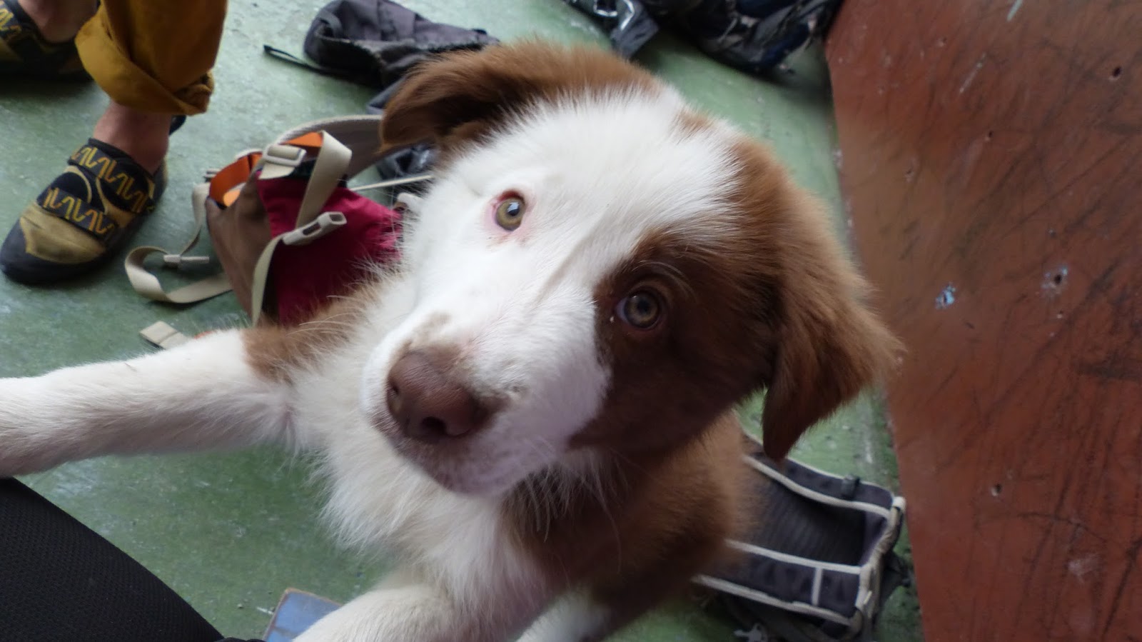
Puppy at the climbing wall. For some reason I didn't climb many routes that day!

Tuesday, 3 November 2015

A Week At The OVT: Day 6


There are a couple of things I'd like to make in my last full-day post about the Observatorio del Volcan Tungurahua. First, that as a geologist you never know what you're going to end up doing today, which makes it one of the world's great jobs. Second, that despite my devotion to geology and associated scientific skepticism, I kind of believe in fate, serendipity, happenstance. I certainly don't think I should; but recently the universe has been sending me more coincidence than I ordered, and I'd like to celebrate that.

On to the first point, of geology being constantly surprising. Liz has suggested that we go to collect water samples today from hot springs around Banos. Cool, great, sounds fine. Except that this is actually a bizarre and intrepid fieldtrip. We march into three hot springs (Agua Santa, La Virgen, and Santa Ana), and demand to go through as we're the IG. In Banos, this means VIP status. Finding the spring to sample at Agua Santa is pretty peculiar: we climb up a ladder, get views of the bathers; hack our way through a forested ditch; and finally reach an iron trapdoor, rusted half-shut. I volunteer to gain a bottle of precious 'holy water' (heated spring water) for analysis back in Quito, and find myself head-first inside a sauna, fishing for sulphurous water. Geology is truly amazing.


It's the bathhouse from Spirited Away! Minus the magic, mostly.

And, on my return, the above picture is my view. The steam from the baths, the bridge over the gorge, even the ladder to get to the source ... it's like a real-life version of the bathhouse from one of my favourite movies, Spirited Away.

On to my second point. Three days ago, I wrote briefly about a particular drive from Banos to Bilbao. Something about that road stuck with me: the greenery of the vegetation, perhaps, or the sudden dazzling panoramas that appeared behind them; something, I don't know what. Do you sometimes see a location that stands out in particular? I really do - the top of Primrose Hill, a tree in Canada, a view in Tenerife. I saw a new location that day, a footbridge with no feet. This is where the universe delivered its latest slice of serendipity: there was terrible traffic on the main road today, and we again took the road from Banos to Bilbao. And I got a photo of the bridge.

The footbridge in question. I don't think it goes anywhere.

Perhaps it's not that stunning. The photo illustrates only a tiny portion of what I saw out of the window. Something about it, though, stunned me; and when I got home I wrote for an hour straight about what I'd seen. Below is the unedited version in raw detail and mistakes. Here's hoping there's a little portion of that view within it.

"Oh, God, I’m not religious but occasionally I get this shiver up my back – have you felt it too? – that makes me think of devotion and piousness, of religious wonder. I think others must get it often, all the time, that’s the only reason people go to church. Anyway. My religious moment - or moments – this afternoon.

Picture this. Slopes of Tungurahua; riding down a lonely road with two friends in the car and one of them at the steering wheel. I’m not in control, no. But we start and suddenly we’re off, driving down the road from Banos to Bilbao (in Ecuador, not in Spain, although I think how strange it is that they have the same names) and what do you see? What can I see? Everything, everything. Everything that I have felt before, every road that I have been on, nothing compares. I seem to remember every minute in my past that I had to tear myself by the hair out from another life, another foggy dream, my head in the clouds and my feet off the summit; and then each of those minutes vanish, and I’m here, only, this brilliant moment is all that matters, and this moment follows that moment follows this moment and – do you see? – I am here, complete, in the present, with nothing else beside me but myself and the landscape that must be the end of the world, so steep are the cliffs and perfectly white the clouds that roar below.

For this is what my journey is like. Listen. After Bilbao we continue. The road is similar to before: dusty, apologetic, a weathered pilgrim to a distant, long-forgotten shrine. The road bows its head, dipping down towards the north. The sun in the west. Pouring its nectar over the hills – and what hills, their vertiginous grace crowned by crops of golden maize and shaggy velvet trees of naranjillas, pocket handkerchiefs of crops tended by dwarves and fairy people, nut brown and wearing peculiar hats, so small you couldn’t see them with binoculars, cleaning their crops so green (but how do they grow so green? Quite contrary. They can’t grow here, it’s impossible, for the crops are above the clouds and we know that the clouds alone bear water) and crops so nourished, grown with pure spring mineral water so different from the gasping orange thread that trickles down the parched gorges, gorges that release dust in a gusty burp but still gorges so wide that rapid rivers must have thundered down here, willingly, stormed angrily past in a huff to reach their destination at the bottom of the ravine, not caring which passers-by they took with them and you know they did, great smooth boulders and rugged pebbles, passengers alike, in the wash of the lahar that came down the valley in a flood of drought; a flood of self-drought that exhausted the valley until afterwards, when it released the last of its vitality in a turbaned whirling dervish of dust. And the dust rises in curlicues and spirals at first, then it grows complex, a network of fractals and matrices that splinter the dying sun into a thousand golden darts, that pierce the veils of the distant hills that you see as you drive forwards: and then everything is saturated in the same hue, layers upon layers, golden millefeuille, and you drive on into the forever shifting sands, the desert in the jungle, and hope this afternoon never leaves you.

It does, in drifts, quietly; like autumnal leaves you don’t notice the lack of until the first brumal snowdrifts arrive on an empty grey pavement. You can still cling to the leaf folded carefully in your journal, the second-rate photos concealed in your camera – signposts to memory, meaningless to all but you. You’ll only mourn this evening, later, too late. For now, your attention is distracted by a new and pretty toy. A good road, newly shod in tarmac and well-pressed, turned out in its best formal; a tyre print marks the only blemish on its skin. You know that a good road like this will lead you to a higher status, outlook and oh! How it does, for past the debris avalanches (the cracked and baked grey stone, you could have sworn that it was a lava flow that passed all the way over the valley) there comes a view, in fact not a view but a hall of mirrors, each reflecting one and the other and what an incredible sight, the green pocket handkerchiefs have appeared again and are waving at you, no bigger than before but now somehow at the top of the hills under which you ride, and on the other side stamped into the blue sky and fringed by white is the regal head-and-shoulders of Tungurahua; only, the elongate neck hidden by a ruff of white like royalty in old portraits. But no matter, the pink-top is beautiful, an ash-laden plume, and the rivens and rapids of the gorges scarred into the land. You wish that you didn’t have to wait years to see a sight this beautiful again.


And don’t forget the details that you saw today as you passed by. The road bridge to Bilbao: the oldest one, rusted girders snapped and the underneath filled with pyroclastic flow; and the younger one, half-finished in concrete and in iron wires, a pathetic attempt to replace the original. The new road that circumvented the need for either bridge attempt. That gorge there: the complete electricity cable, the eroded and excavated lava flow. Brilliant orange nastursiums, growing wild and coated with dust. That light through the valley. The wind that blew through, northeast to southwest, and with it brought the scudding and rearing clouds. Why were they all white, except for that small grey one? That footbridge. Oh, that footbridge: you’d read something similar in Into The Wild, where Christopher McCandless was trapped for winter for want of a footbridge being washed downstream. Was this one washed out? You don’t know, only that you are intensely curious about what happened to it. A suspended system, like a Golden Gate in miniature; and, true to the name, the threads of the suspension bridge are gilded in gold-leaf by the sun passing through and tipping its hat in greeting. A beautiful bridge, could not be more friendly: on your side the grass is greener, it shines brilliantly in the afternoon light. On the other side the bridge ends in dank and tepid jungle. The scariest part is that there are no planks, not one: though the outer wires remain to support them, they do not exist. There is no way to cross." 

Now there's no such thing as fate, of course. My nights at Tungurahua have been tranquil and smooth. On our last night, at half-past ten, we received a call from one of the vigias. Had we seen the eruption?, he asked. He was true to his word, for as we looked out with the night-vision goggles we could see the incandescent bombs being hurled from the summit. We flew to the car, and rode up to the viewpoint at Huayarupta. We stood looking out, and watched the end of the fireworks display with the goggles. There they were, the sparks flying darkly, and the stars keeping watch.

Well done if you got to the end! Here's my first GIF as a reward. It's filmed from the new, good road mentioned in my fourth paragraph.


A Week At The OVT: Day 5


Several months ago, I went on a trip to the Amazon. As everyone can tell you, it's an incredible experience. Almost every sight and species you could possibly imagine, from A to Z; all found through a series of screens, densely forested by ads and creeping links, the latter steadily growing purple as you find new scenes that you also like.  I'm proud to say that in my intrepid trek through the jungle of the internet, I was the perfect traveller: I took no pictures, and left not even online footprints (thanks to my browser tools, I cleared the trail of cookie crumbs behind me). However, I did return home with a single souvenir: a copy of a book, entitled Microadventures, by Alastair Humphreys.

I love receiving mail. It's like Christmas come right on time for me, whether it comes in January or in October. This parcel arrived in June. I tore open the brown packaging to reveal a glossy new book, fresh and uninjured. Not for long! I cracked its spine and skimmed through several of its ideas: A Rafting Adventure. From Summit to Sea. and - Close Your Eyes. Go! Here were ideas galore, a treasure trove in glorious print. I closed my eyes, and prepared to dive in.

And, of course, didn't. I aspire to adventure; and no-one who knows what I have been up to since June would say I'd stayed at home and sat on my arse. Festivals, art, charity cooking, climbing volcanoes; all came and went in a technicolour blur, half-remembered in albums stored on my laptop. But did I have adventures of the footloose and fancy-free, spontaneous kind? In my opinion, relatively few. At one point I decided enough was enough and made a bid for freedom: some of my friends may remember a slightly slapdash group text in which I tried to organise a sleep-out under the stars. An adventurous, august idea; but living in London, ultimately foolish. Taking a sleeping bag to Regent's Park and spending the night there would result, almost inevitably, in you being mistaken for a hippie or a tourist and being taken advantage of by someone similarly spontaneous and vastly more streetwise.

Part of the problem of microadventuring was my living in London; ironically, in the city's sprawling, raunchy chaos, it's difficult to live a life unplanned. Now that I am in another world entirely, and exploration is easier. I'm still fascinated by simple things like Ecuadorian streetlights; so how hard can a real adventure be?

So, enough shoegazing (for now). What was I talking about? Yes, the Amazon, its endless biodiversity and travel network and veins of pulsing life. Imagine travelling that! Now, there's a bold adventure, and I had a similar one in mind. You'll remember the mysterious mud from yesterday's post? If not, I understand: a lack of interest in mud is as common as muck. However, bear with me here, because a journey grounded in something so mundane as liquid earth can have quite an unusual denouement. Think of the lazy Amazon, or the swarming Nile. Both begin as a trickle in the mountains. And yet, where these rivers reach their end, there grow vast and engorged cities, that feed off the fertile land that grows there. My personal Nile is a rusty orange thread of water in a narrow and wizened gorge; still, better than nothing, I suppose. I am there with all my explorer's gear: compass clinometer, camera, water, boots. I am ready to go. We're on the trail of a mysterious lahar. In our own unusual, microadventurous way, we are charting the source of the Nile.

Start:

The roots of trees cable, like power outlets, flick lithely on the ground. We're unplugged here, and trip over in our astonishment. Occasionally bird sing; other than that there is no sound. The ground is soft, the weather fair; white clouds held aloft, like bedding there in the sky - in places, peeking through, I spy the most amazing blue. The undulating ground that we may try to press our rememberances into, but unlike on Amazon, here my footprints will go unnoticed.

What is there to show and to tell? Too much, most of it invisible.

1. Mystery cat. 
Our first foray to find the water source takes us up a river valley carved from bedrock to the base of a waterfall, where we find more orange mud. Lightly pressed into it are some mysterious paw-prints. Lynx? Cougar? The spoor size suggests this is a lot larger than a housecat. Underneath the knick-point in the rock, I look out at the dense vegetation around us and imagine a dozen pairs of eyes looking back.

2. Scrambling. Life grows in every crook and nanny, and the steep rock in the valley is polished smooth by sources inhuman. Plenty of our steps up the valley are saved by a last-minute cling to an opportunistic tree root.

3. Shapes and angles. Near the top of the river valley, we see crops springing at ninety degrees from the hill. Amazing. A slew of large black birds spiral ominously overhead on the wind currents. Ten minutes later, our route ends below an impassable rock wall.

4. The road less travelled by. There appears to be two sources to the orange mud. We are now following the western trail, having been stopped by the wall in the east. We walk up a narrow alley created by erosion of a pyroclastic flow. More recent lahars have worn down the flow until they have formed a passable avenue, sort of. As we climb up the volcano, our alley gets deeper and deeper. The wind tears down it, louder and angrier, bearing news from the throat of fire above. Alarms begin to ring as the towering sides of the alley begin to fall: rockfall, like drizzle at first, increases to a monsoon roar. I think I'm like Indiana Jones, being driven back by rolling boulders - except these ones aren't papier mache, some of them weigh most of a ton. In a whip-crack moment, we decide to retreat in a whip-crack moment.

5. Artefacts. On our escape from the boulders, we notice a drystone wall built into the side of the pyroclastic flow. It's beautiful, red-and-black, a piece of work worthy of Andy Goldsworthy. What artist built it, and why?

6. Return. We're above the eastern wall now, and can continue up the river valley. The ground is so soft here. We walk through sand dunes that sift eastwards in the wind towards a flowered wall of vegetation. An occasional glimpse through the vines shows a dizzying height to the valley carved below. We still can't find the source, and now we're above the line of the crops. The source is certainly no run-off-the-mill burst pipe from local farming, but something still mysterious. And yet, we can't go further. A second wall of rock imposes on us from a hundred metres above. It itself must be forty metres high. I pick up a mossy staff of wood, and rest it in the ground. 2571m, says the GPS. It's the highest I've ever been on the volcano, and higher than many of the IG staff.

We're tired from the heat of the day, and our vain efforts to find a source. We slide down the bedrock of the river valley, a free waterpark with no queues. At the bottom our earlier footprints are noticed by Liz. She puts her boot beside a track in the mud. It's her, all right. 

I know this isn't an amazing adventure. If you boil down my words into the basics, here's what I did on Sunday:
Tl,dr: saw some mud, looked for water; walked up a valley, did not find water, walked up a hill, still did not find water.
But it isn't important. It doesn't matter that we didn't find the source, or the cat, or the creator of the wall. It's in the way I tell the story, and the way that I felt about it. Cat's footprints - big deal, you could say; but at the time they were imbued with mystery, and those bird's calls, danger. I didn't find the source of the Nile, but I had a microadventure; and, curiously enough, it was brilliantly exciting. As Alistair Humpreys said in his introduction, 'Start small. But do start!' If you do, you may find the adventure bug will get to you. Me, myself? I'm already plotting one for this Friday.


Where all the trouble started.

Recent lahar erosion through the pyroclastic flows of 2014.
Both of these processes are
powerful, partially because of
the steepness of Tungurahua's flanks.

Retreat from the eastern wall.

A 'flutterby' provides a bright spot.

The lahar alleyway, approximately fifty metres before we had to turn back.
Rocks were falling in every direction. 

We made approximately 500 LOTR jokes while climbing these slopes. A nerd in one aspect equals a nerd in many.

My staff pointing the way we'd come.

Victory! Of sorts; at 2751m on Tungurahua.
The impassable wall is due south, in the background.


Here's the website of the author who inspired this post. Highly, highly recommended! Go.
Here's the link to the Amazon page where you can buy this product (Buy). NB. I'm not responsible for how deep your Amazon rabbit-hole goes.

Sunday, 1 November 2015

A Week At The OVT: Day 4


For most of the people around Banos, today marks the beginning of a holiday. A Hallowe'en Saturday, Sunday, Monday holiday, Tuesday Dia de los Muertes; all together, what a pleasure! To us at the OVT, we're at work. For me, I don't see lights or sound or colour. This post is about mud, and murk, and mystery.

Today is Saturday, October 31st. Yesterday, our early morning sunshine had darkened into cloud by the early afternoon, and from our house in the valley we saw grey clouds pass us by. Nevertheless, there was no rain upon the mountain. We saw none, and our omniscient instruments agreed. And yet two of our vigias told us they had seen a lahar on the mountain, crossing their paths with some speed, a racing stripe on the mountain. Where did it start? This unidentified flowing object could have no source that we could think of; there was no rain on the mountain, and we'd seen dust bowls blowing off the hills the last two evenings past.

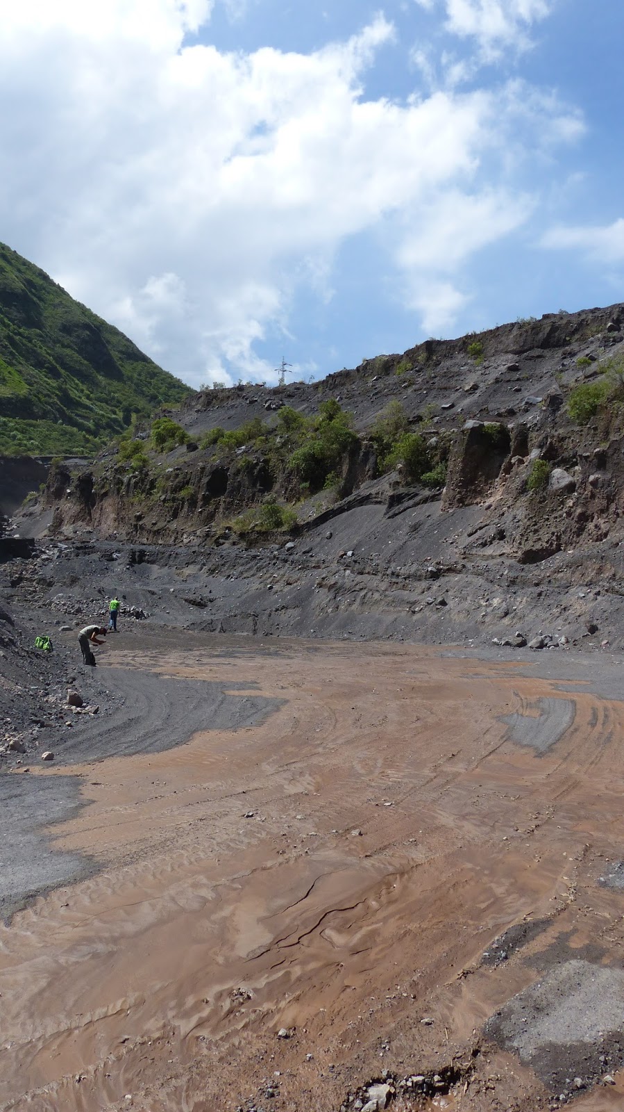
Back to today. In the late morning, we travelled to the quarry where the lahar had been observed. It was there, all right. A vivid orange-brown mud, a paint bucket dropped on the quebrada floor, who knows from where. When we touched it the mud coated our fingers like tempered chocolate. The base of the stream offered a fine view up the valley; we would be able to walk up the streambed and find the source, provided it did not rain overnight.
UFO turns out to be lahar. Here's the one the mountain made earlier.
Appearance of active flow (foreground) and its finale (background).

Now, as fascinating and visceral as the topic of viscous mud is, that's where I have to leave the story. We have decided to discover the source of the UFO tomorrow morning instead. Nevertheless, in this active country we live in, there's usually something else to take its place. I present to you:

DRUMBEAT SEISMICITY AT TUNGURAHUA VOLCANO

As seen and described by Patricio Ramon, and to me by Liz. The stages are:

1. Two to three days of ash emissions, accompanied by emission tremors on seismograph (long signals, moderate amplitude of continuous size). This corresponds to the beginning of the OVT week, when we observed ash plumes rising from Tungurahua on Wednesday.
2. A day or two involving decrease in activity, with emission tremors decreasing in amplitude.
3. A short period displaying occasional long-period (LP) activity, perhaps 12 hours. In this period, the LP events appear as small-amplitude screw-shaped signals on the seismograph, with an event lasting under a minute and appearing every few hours.
4. A period of increasing activity with regular LP events forming a 'drumbeat'. One every minute or so (look for the tiny kink band on the seismograph, each one defines a new minute). Drumbeat seismicity is so-called because of the regularity of the events.
5. New Eruption or Emission!

Seismograph, mid-afternoon. 
In detail, late afternoon: large teleseismic event occurs before
swarm of small, regular long-period (LP) events.
Also seen here - two large teleseismic events today (larger amplitude, long-distance, single events). I hope we'll see a new emission tonight; if it's clear, we may see some incandescence later (we are currently at 18:17pm).

DB seismicity caused by either viscous plug movement or escape of gases from magma-conduit boundary? (Mario Ruiz). Second hypothesis never heard of by Liz for lasting for such a long time; but apparently recorded at Montserrat.

NB! Drumbeat seismicity is formed by a repetitive, non-destructive source (see notebook). It usually suggests dome formation, as at Mount St. Hekens in 2004 and 2008; the drum beats illustrate movement upwards in the conduit of highly crystalline magma. The IG's soot seimograph is useful for on-the-dot info, rather than longer-term monitoring. Dome formation would be disastrous for Tungu, because dome formation, and its eventual collapse, would form larger pyroclastic flows. The extremely steep flanks of Tungu would channel these flows into vulnerable, populated areas. However, dome formation may not be conclusively proven from drumbeat seismicity.

For all the science that I've just spewed, there's nothing like the visceral thrill you get from waiting for a volcanic eruption. I spent an hour in the OVT's main room, breathless, waiting for Step 4 to transition into Step 5. Outside in the valley, the light changed from pink to grey; and I stood there, waiting, waiting for Tungurahua to blow.

We spend the evening in Banos. On the streets there were so many people. Young, old, strangers, locals. A busker passes us by; he is going to make a killing tonight, because it's the first night of the long weekend, that ends on Dia de Los Muertos, or All Souls' Day, this Tuesday 3rd November. All the others are out for a party, but I am otherwise preoccupied, still thinking about the muddy water we'd seen earlier. Pretty sad, you might say. Or, you've got a filthy mind! Only half-right. This is a fantastic mystery. I'm pretty sure I know where most people would end up tomorrow - in their bed or someone else's, possibly feeling pretty hungover. I'm not judging. I've done that plenty of times before, and I will definitely do it again. But of all the people on the streets of Banos, they know where they're going to end up tomorrow morning. I don't, and that is what geology has given me. Tomorrow we're going on a microadventure, to find the source of the orange thread.

Saturday, 31 October 2015

A Week At The OVT: Day 3


If you are wondering how a day involving a swing off the roof of the Earth could possibly be topped, then continue reading. For the record, I'd like to say that a day like yesterday can easily be trumped - provided that (a) you are a rock nerd and (b) you have great colleagues.

Be prepared to use your thinking hardhat, and I warn you: there's some hard-core science ahead. However, I'm sure you'll love it, or at least be used to it by now. After all, my life: rocks!

Tl,dr: Today was a full day in the field. It involved studying pyroclastic deposits; identifying historic andesite lava flows; finding half-buried houses; walking up a volcano on land almost more recent than my last haircut; and the most beautiful road in the world.

Here's a photo tour of my day.

1. Pyroclastic flow and fall deposits, by Banos Bridge

Tephra fall deposit (dark band) separates pyroclastic flow deposits.
This is a great outcrop just west of Banos. The fall deposit (dark band) is well-sorted, and shows some gradational bedding (fining upwards). It separates pyroclastic flow and surge deposits, which are far more poorly sorted. Both the lowest pyroclastic flow and the fall deposit above it seem to have created an effective topography, which the first pyroclastic flow event above the fall deposit has filled in. The series of gradational clast sizes you see above the dark band illustrate a series of successive pyroclastic flows; there are at least three.

2. Difference between flow and fall clasts (from previous outcrop)

Clasts from pyroclastic flow (left) and tephra fall (right). Differences
in internal colour and degree of vesiculation.
3. Colonnades and entablature in historic lava flow, north of bridge into Banos

Beautiful andesitic lava flows.
Amazing columnar jointing in historic andesitic lava flows. This outcrop may represent two different events, with different morphology created from shear forces. However, they could be from the same event, with the lower, straight columns the colonnade, and the upper, entablature.

4. House destroyed by pyroclastic flow from eruption 16th August, 2006

'Seriously, you need to hoover this place. It's disgusting.'

This house was destroyed by an ash-and-rock-laden gas cloud; believe it or not, there's another storey under the earth here. More unbelievable, the neighbour's house, 25 metres along the road, only suffered light ashfall. The house is still inhabited, and has an impressive collection of dirtbikes outside.

5. Daniel with rock - who won?

Answer: the rock.

6. The awesome power of a pyroclastic flow.

Between a rock and a lahar place.
The foreground shows a complete block of lava with autobrecciated a'a' top and internal shear flow features below; this block is about 1.5 metres square and was carried down the volcano by the pyroclastic flows on February 1st, 2014. Shows the incredible power of the volcano! Tungurahua's summit is in the background: covered in cloud, 3000 metres above.

7. Looking north to OVT, with recent landslides. 

Straight up, these landslides are HUGE.
We're at about 2100 metres altitude, looking directly north into the valley where the Observatorio del Volcan Tungurahua lies, just outside the village of Guadalupe. The landslides are enormous, several hundred metres high; they regularly take out roads around this area.

8. Tungurahua in cloud.

How do you hide a mountain?
This was taken at 4pm, at the end of the most beautiful road ever. Banos to Bilbao and beyond, via Chimborazo Province.

Things you didn't see, because I didn't take pictures: a dumper truck full of children, a footbridge with no feet, dust storms in a rainforest valley, a wildly outrageous gorge; two road bridges destroyed by liquid earth.

Thanks to Liz and Daniel for a brilliant day!